
SPRINGFIELD, Ill. (WAND) - Twelve tornadoes were confirmed across central Illinois during last week's storms.
According to a tornado survey from WAND meteorologist Alivia Colon, there were EF-1 tornadoes in Springfield, near Tallula, near Athens, near Ludlow, near Hoopeston, Mt. Pulaski/Forsyth, Champaign-Urbana, outside Danville, near Bement and Paxton/Loda. Additionally, there were EF-0 tornadoes in Harpster/Elliott and near Argenta.
NWS stated an EF-1 tornado in Springfield had a max wind of 110 mph and touched down just after 11 p.m. at the Abraham Lincoln Capital Airport. The tornado continued for around 20 miles with a max width of 250 yards before dissipating in Mechanicsburg.
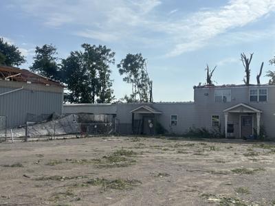
The tornado caused heavy damage at the airport and the Animal Protective League shelter.
APL's building on Taintor Road suffered significant damage, but all animals at the shelter were rescued in time.
WAND News viewer photos captured damage at the airport, including several small planes thrown into fences. Another image showed a plane without any wings or a tail.
NWS added that there were two EF-1 tornadoes that touched down in Menard County.
The first had a max wind speed of 107 mph, which touched down around 10:50 p.m. three miles northeast of Tallula, and its max width was 150 yards.
The second tornado touched down two miles west of Athens right before 11 p.m. and traveled around three miles to the south edge of Athens.
Its max width was 200 yards, and its max wind was 105 mph.
Severe storms with tornadic potential are possible again across central Illinois on Wednesday.
Stay up-to-date with local weather through WANDTV.com, or with the WAND Weather app.
Copyright 2026. WAND TV. All rights reserved.


