
DECATUR, Ill. (WAND) - Despite a few flurries northeast of I-74 this evening, dry and cold air is spilling across the region. It's this dry air that will allow a little later onset to precipitation this weekend. Regardless, a major winter storm is imminent.
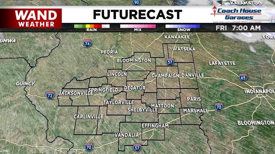
7AM Friday for those that are out shopping, or just enjoying the day, it'll be the calm befor the storm. The sun will have just poked its head above the eastern horizon. Temperatures will be in the upper teens to low 20s. But, this time around, there will hardly be any wind.
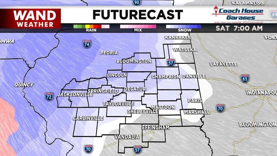
Fast forward to 7AM Saturday. Clouds will hang low across our area. Snow will be falling in many areas, albeit light to moderate. Western locales will already have a small accumulation as the temperature profile remains below freezing. Sure, we did have mild weather with mild ground temps for most of this month, but this cold air and storm mean business. Remember Halloween 2019? Two inches of wet snow for parts of central Illinois. That was after a lot of warmth. The bottom line: if the storm is strong enough, it will be able to accumulate, even on the road. During our winter weather special we mentioned the couple of ways we get heavy snow. Gulf moisture running over the top of a warm front was one of them, and that's exactly what will take place this weekend. At the height of Saturday's storm expect 1" of snow per hour. Anything that can be put off until another time probably should.
Stay safe, stay weather-aware and stay warm. Enjoy the rest of Thanksgiving and the quiet weather for Friday.
Copyright 2025. WANDTV. All Rights Reserved.