

DECATUR, IL. (WAND) - Happy Sunday! We’ll be feeling the full range of spring between today and tomorrow with our next weathermaker.
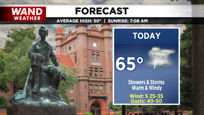
A cold front moves in today, and it brings showers and thunderstorms as early as late morning. However, by the late afternoon, a more widespread round of storms will roll through. Highs today are in the mid-60s.

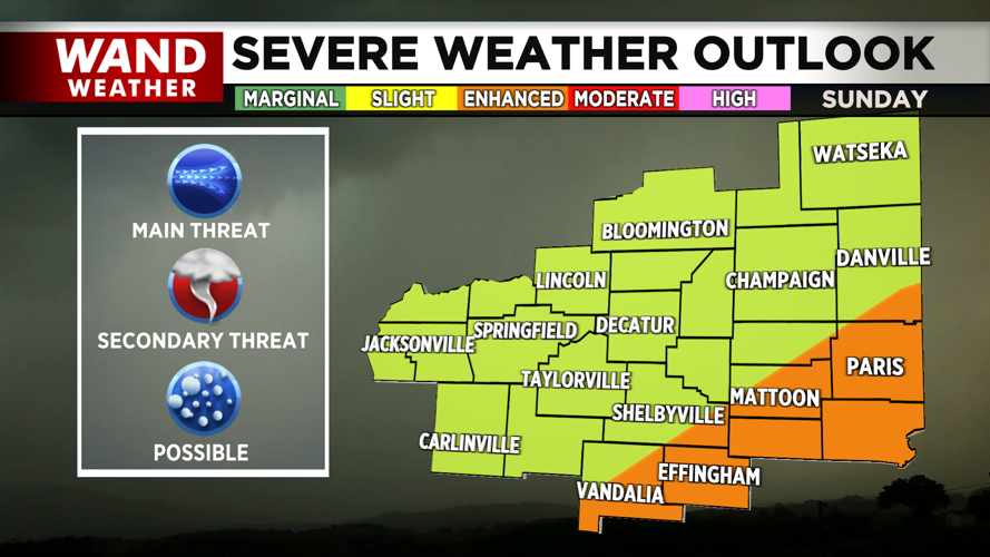
A slight/enhanced risk for severe storms is in place across the region. Our main concern will be damaging gusty winds, but an isolated tornado embedded within the evening line should not be ruled out. Large hail will also be possible between storms this morning and evening, particularly along the Illinois River.

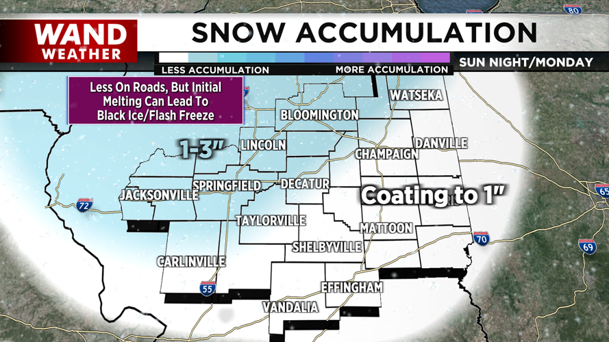
Behind the rain, another round of showers arrives as snow showers. Temperatures drop into the low 20s overnight. While snow totals will be on the lower end, much of the area can at least expect a coating on grassy surfaces. For snow showers that linger into Monday morning, gusty winds may lower visibility during the morning commute. Initial melting paired with the flash freeze may create concerns for black ice and slippery travel tomorrow morning as well.
Behind the frontal system, gusty winds and cold temperatures continue. This will allow wind chill values to reach the teens and single digits early Monday, and single digits and negatives early Tuesday.
Have a great day and stay weather-aware!
Copyright 2026. WANDTV. All Rights Reserved.


